




The best nature spots in Luxembourg for a weekend escape

The Mullerthal, nicknamed "Little Switzerland of Luxembourg", offers 112 kilometres of marked trails through spectacular rock formations and waterfalls.
The Haute-Sûre Natural Park offers lake and Ardennes forest landscapes ideal for hiking, cycling, and water activities.
The network of hiking trails covers the entire national territory, making it possible to reach most natural sites without a car thanks to the country's free public transport.
Luxembourg is often perceived through the lens of its financial capital and European institutions. Yet behind this image, the country conceals a surprisingly varied and well-preserved natural environment for a territory of just 2,586 square kilometres. Deciduous forests, steep valleys, crystal-clear rivers, sandstone cliffs, artificial lakes surrounded by hills, Luxembourg's landscapes regularly surprise those who discover them for the first time.
For expatriate professionals and cross-border workers settling in the region, these natural spaces represent a precious resource for unwinding after an intense working week. Here is an overview of the must-see spots for a successful nature escape.
The Mullerthal: wild nature on the doorstep of the capital
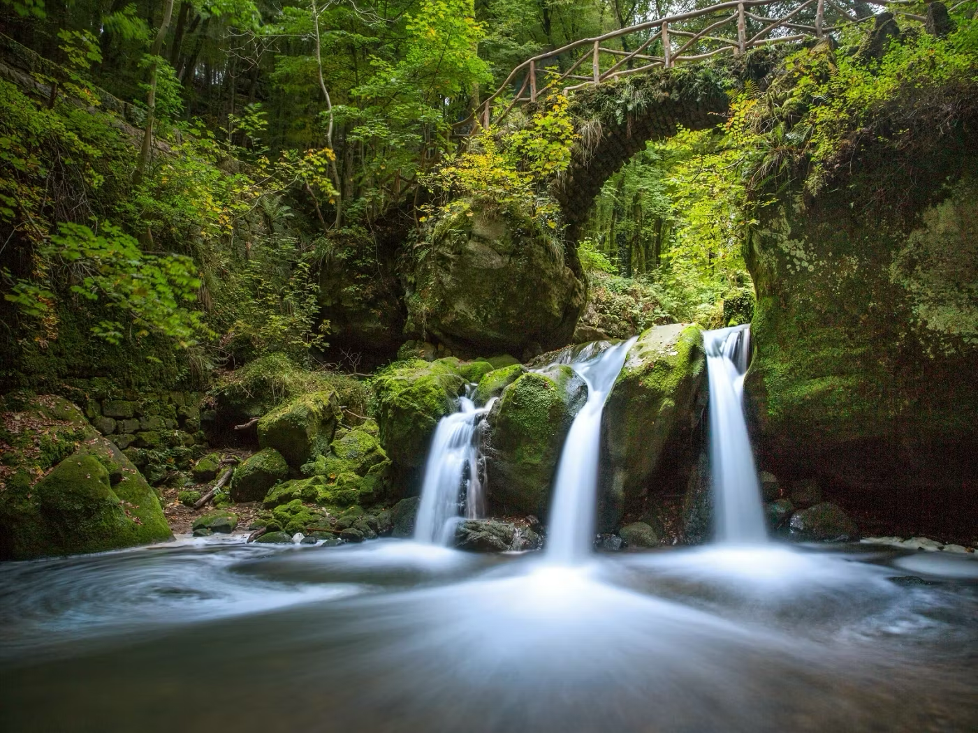
The Mullerthal region, located around forty kilometres east of Luxembourg City, is unquestionably the country's most iconic nature destination. Nicknamed "Little Switzerland of Luxembourg", it owes its name to its impressive sandstone rock formations, sculpted over millions of years by the rivers and streams that cross the region. Narrow gorges, caves, waterfalls - including the famous Schiessentümpel - and lush vegetation make up a landscape of rare visual richness.
The Mullerthal Trail, a long-distance hiking route awarded the "Leading Quality Trails, Best of Europe" label since 2014, stretches over 112 kilometres and is divided into three main loops accessible from the villages of Berdorf, Echternach, or Müllerthal. The routes cater to all levels: the first loop, the most popular, offers technical passages through the rocks alternating with open views over the wooded valleys. Shorter variants, generally between 8 and 15 kilometres, allow visitors to enjoy the terrain without committing to a full day of walking. Echternach, the main gateway town to the region, has a designated swimming lake that rounds out the offering for families during summer weekends.
The region is accessible by public transport from Luxembourg City, with regular bus connections. Once there, several accommodation options, guesthouses, and restaurants serving local produce make it easy to organise a complete getaway without a car for those who wish to make the most of the trails.
The Sûre valley and the Oesling: the wild north
The north of Luxembourg, known as the Oesling - or Eislek in Luxembourgish - is another favourite destination for nature lovers and outdoor enthusiasts. This Ardennes region, less frequented than the Mullerthal due to its greater distance from the capital, offers landscapes of wooded hills, moorlands, and rivers that evoke the vast wild expanses of the Belgian Ardennes. The Sûre river, which crosses the country from east to west, forms the backbone of this natural area.
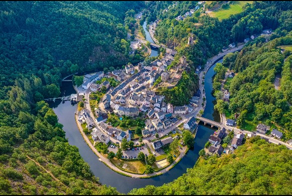
The Haute-Sûre Natural Park, established in 1999, protects a territory of more than 350 square kilometres around Lac de la Haute-Sûre, Luxembourg's largest lake. This artificial body of water, surrounded by deciduous and coniferous forests, is ideal for hiking, mountain biking, canoeing, kayaking, and fishing. The village of Esch-sur-Sûre, nestled in a bend of the river with its medieval castle looming overhead, is often described as one of the most beautiful villages in the country. Several marked hiking loops allow visitors to explore the surroundings on foot, with more pronounced elevation changes than in the rest of the country, between 200 and 400 metres depending on the chosen route.
Access to this region by public transport is possible but less frequent than for the Mullerthal: having a vehicle is recommended, or planning journeys well in advance. In return, the lower tourist footfall guarantees quieter trails, particularly outside the summer season.
The Moselle and the vineyards: nature and heritage along the river
The Moselle valley, which forms the natural border between Luxembourg and Germany for around fifty kilometres, offers a very different face from the regions described above. Here, nature blends with viticultural heritage in a landscape of terraced vineyards, picturesque villages, and well-kept riverbanks. The banks of the Moselle are dotted with cycle paths and walking trails that allow visitors to travel on foot or by bike between the wine-producing villages of Remich, Stadtbredimus, Grevenmacher, and Wasserbillig.
This region is particularly well suited to family outings or leisurely weekend strolls: the terrain is virtually flat, the distances are short, and the villages offer numerous opportunities for a gastronomic break. Local wine cellars regularly host tastings open to the public, and several guided river cruises depart from the landing stages at Remich or Grevenmacher.
For those seeking a more demanding hike, trails climb from the Moselle riverbanks up to the wooded ridges overlooking the vineyards, offering panoramic views over the river and the German countryside on the opposite bank. The Visit Luxembourg portal lists all of the country's marked trails and allows visitors to plan their excursions according to their preferred difficulty level and duration.

Conclusion
Luxembourg offers its residents and visitors a wealth of natural spaces within easy reach, often accessible in under an hour from the capital. Whether you enjoy sporting hikes through the gorges of the Mullerthal, a peaceful stroll along the Moselle, or an immersion in the Ardennes forests of the Oesling, the country offers a palette of landscapes that provides a welcome contrast to the intensity of Luxembourg's professional life. For newcomers, discovering these spaces is also a way of putting down roots in their new home and appreciating its quality of life beyond the well-trodden paths of the capital.
FAQ
Is the Mullerthal Trail suitable for beginner hikers?
The Mullerthal Trail includes technical sections with passages through the rocks that can be physically demanding. However, shorter and less challenging variants exist on each of the three loops, generally between 8 and 12 kilometres. Appropriate walking gear with grippy-soled shoes is recommended, even on the easier sections.
Do you need a car to explore Luxembourg's natural areas?
Most of the key natural sites are accessible by public transport from Luxembourg City, with buses and trains free of charge throughout the national territory. The Mullerthal is served by direct connections from the capital. For the more remote sites in the north of the country, particularly in the Oesling, having a vehicle does make getting around easier, especially outside peak hours.
What is the best season for hiking in Luxembourg?
Spring (April, May) and autumn (September, October) are generally the best periods for hiking in Luxembourg, with pleasant temperatures and particularly spectacular vegetation. Summer remains a viable option, but the most popular trails — such as the Mullerthal Trail — can get busy at weekends. Winter offers snowy landscapes in the Oesling, though some passages may be slippery.